- trueCollege of Natural Science,EES06/22/2023Ask the expert: How can the Chignik, Alaska, earthquake help predict future risk?Earthquakes are caused by the movement of the tectonic plates that make up Earth’s crust. Between 2020 and 2021, the Pacific plate and the North American plate off the coast of Alaska slipped along the Alaska-Aleutian fault, producing a series of earthquakes, including the Chignik, Alaska, earthquake on July 29, 2021, which registered an 8.2 in magnitude. MSU’s Jeffrey Freymueller is researching this earthquake to learn more about exactly where that slip occurred (and how much) to better understand how faults work and the risk of future earthquakes and tsunamis.
- Earthquakes are caused by the movement of the tectonic plates that make up Earth’s crust.
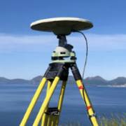
- The Chignik, Alaska, earthquake on July 29, 2021 registered an 8.2 in magnitude — the largest earthquake within U.S. territory in 58 years.
- MSU Professor Jeffrey Freymueller is researching this earthquake to learn more about where, and how much plate slip occurred, to better understand how faults work and to help evaluate the risk of future earthquakes and tsunamis.
Emilie Lorditch
 Ask the expertEarth and Environmental Sciencesearthquakesfuture risk