Ask the expert: Take me on a science sea cruise
Article Highlights
- Songqiao "Shawn" Wei is an associate professor in the Department of Earth and Environmental Sciences at Michigan State University who recently helped lead a research cruise to the South Pacific.
- For Wei’s project, he and his colleagues deployed seismometers to the bottom of the ocean to learn more about a region known as the Tonga subduction zone.
- In this Q&A, Wei shares more about his science and the experience aboard one of the United States’ largest research vessels.
As a teen, Songqiao "Shawn" Wei loved playing a Japanese video game called “Uncharted Waters,” taking on the role of an ocean-faring explorer. Little did he realize that his dreams of exploration would take him from his home in China to leading a project on board one of the largest research vessels in the U.S.
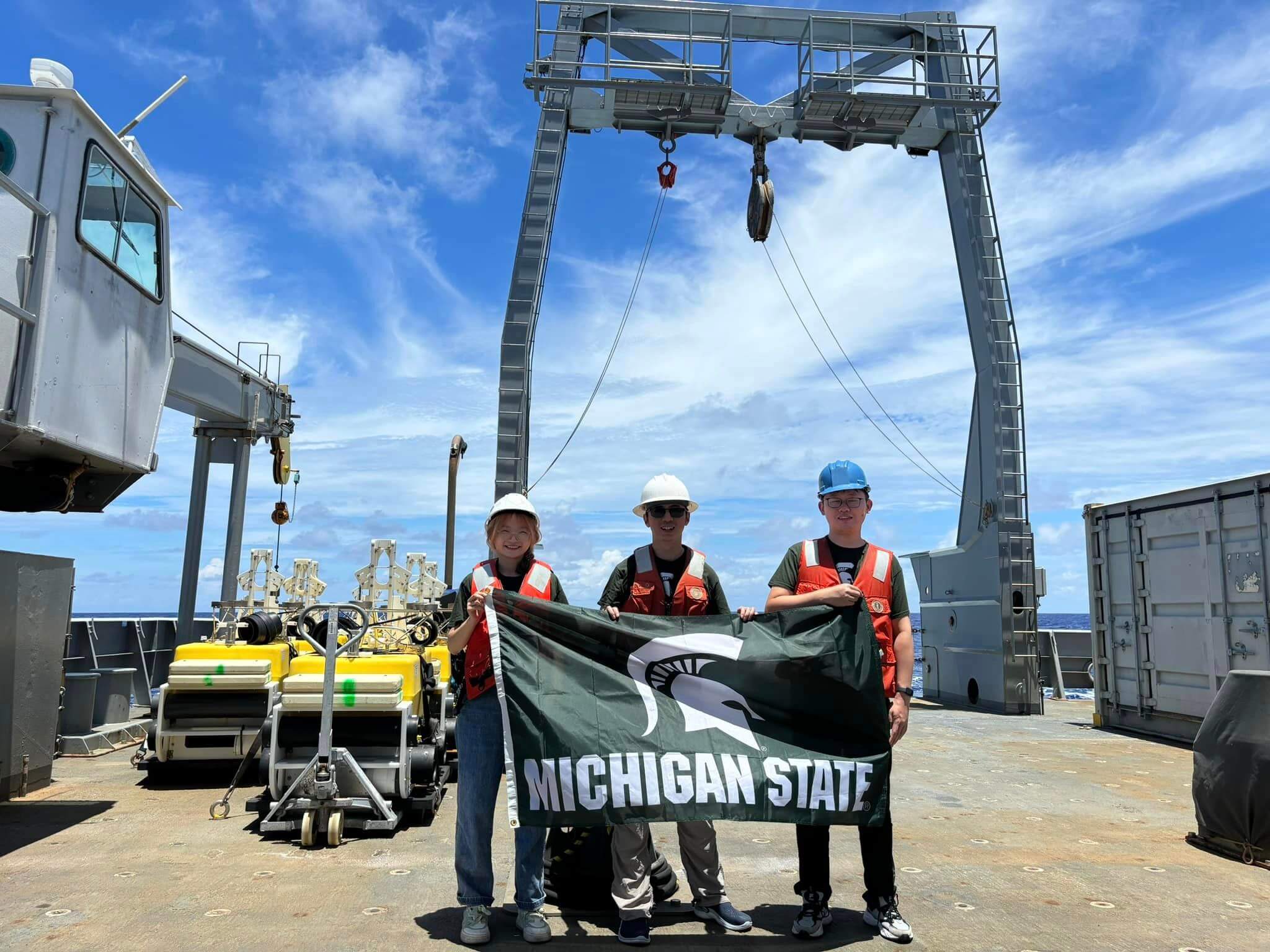
Now an associate professor in the Department of Earth and Environmental Sciences at Michigan State University, Wei recently returned from an extended research cruise in the South Pacific to investigate what's going on beneath the seafloor.
Funded by the National Science Foundation, the project took Wei, his research team and their colleagues from four universities on board the U.S. Research Vessel Thomas G. Thompson to the Tonga subduction zone. The cruise deployed instruments and collected seafloor samples from the waters of five island regions and countries, including Tonga, about 1,500 miles north of New Zealand.
Wei will return in 2025 to collect the nearly 30 seismometers that his crew left behind and begin uncovering all the geological data they reveal. The College of Natural Science communications team asked him to share some insights about the science behind the expedition, as well as his personal experience on board a research vessel half a world away from East Lansing.
This conversation has been edited for length and clarity.
College of Natural Science: Tell us some of the logistics about getting to and doing research in this part of the globe, far away from MSU.
Songqiao "Shawn" Wei: We had three separate flights. First, we flew from Detroit to L.A., then to Fiji, then to Samoa. In total it was about 40 hours.
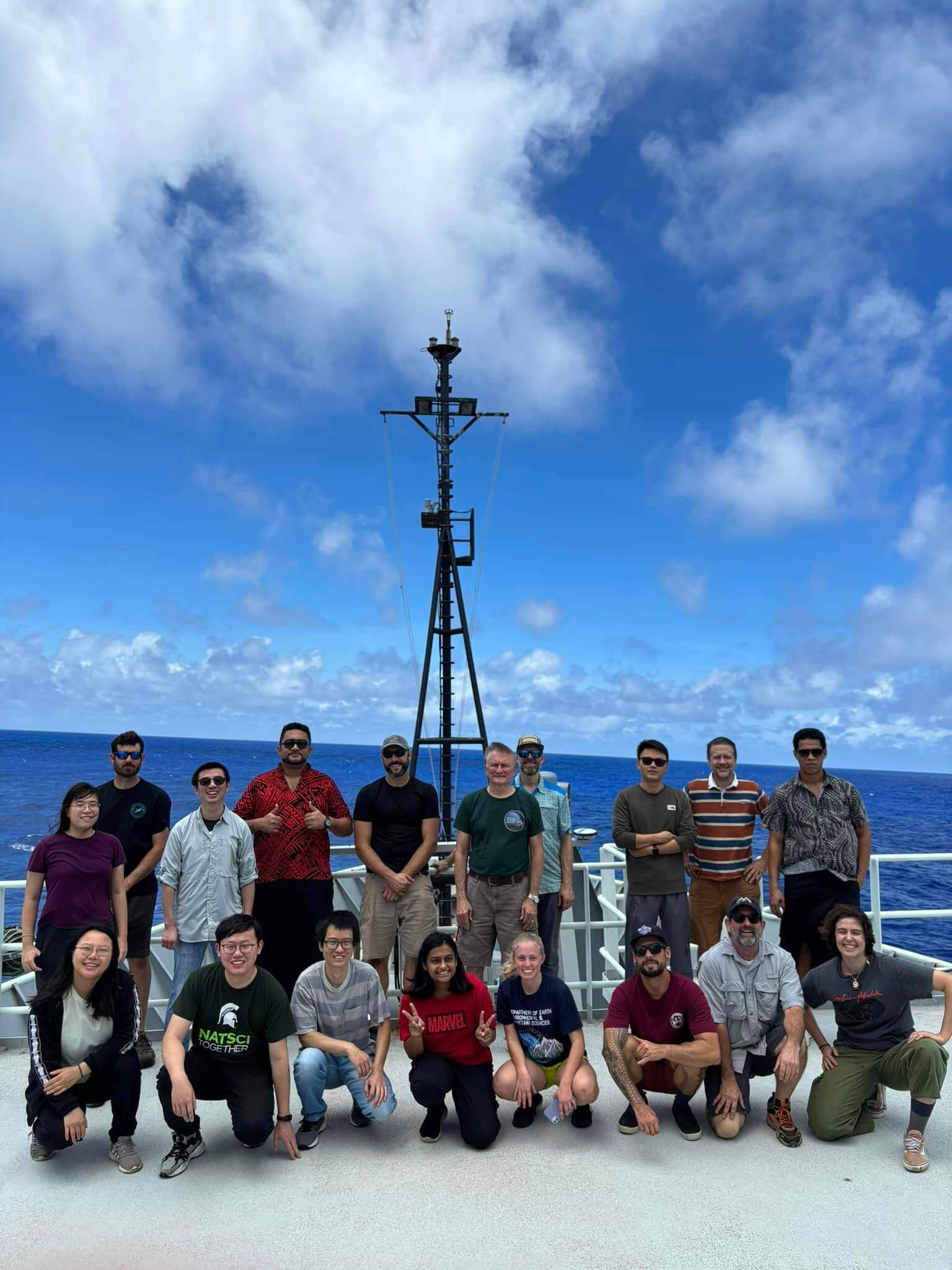
There were about 40 people on board: 21 crew members and a science crew of about 20, including technicians and three professors, nine students and postdoctoral researchers from MSU, Washington University in St. Louis, the University of California, Santa Barbara, UC San Diego and Oregon State University.
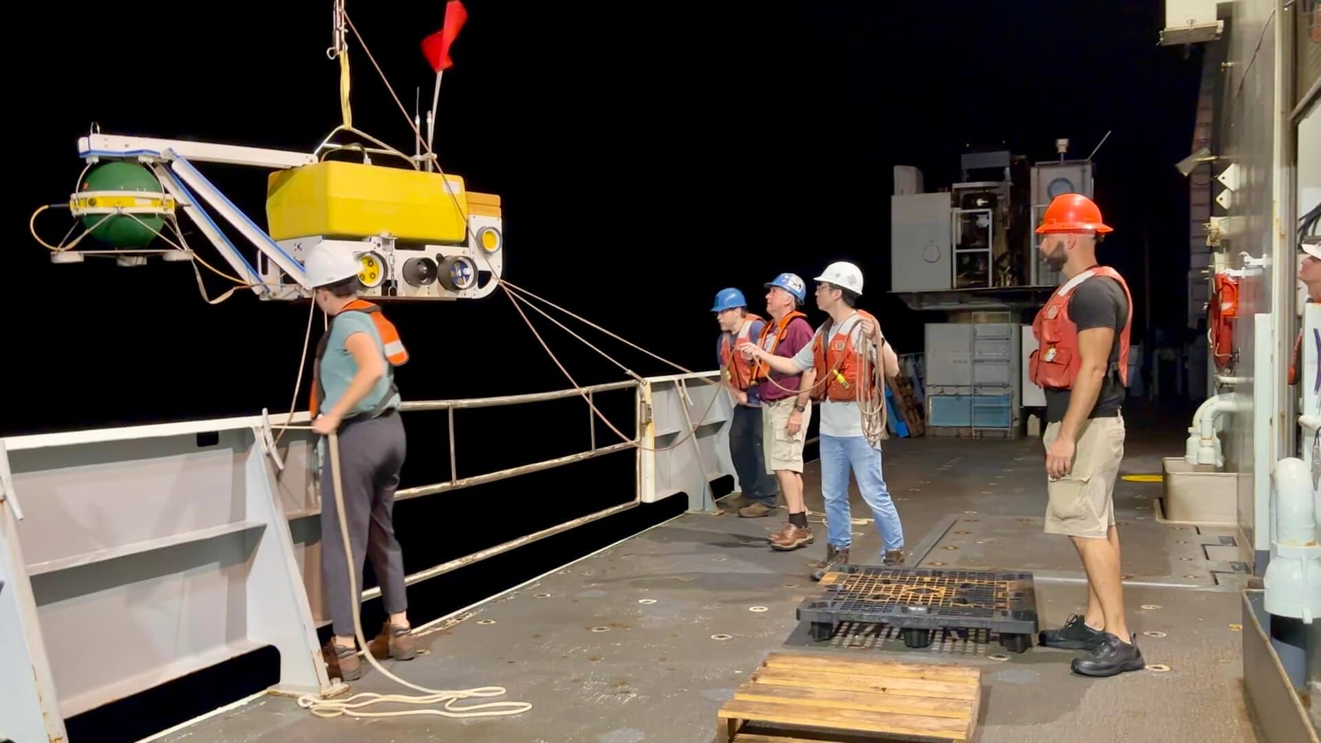
Researchers deploy an ocean bottom seismometer from the U.S. Research Vessel Thomas G. Thompson.
The ship is owned by the Navy and operated by the University of Washington in Seattle and is part of the University-National Oceanographic Laboratory System, or UNOLS, which made it easy for me. I didn’t need to find a captain or crew members.
Also, very importantly, we have wonderful shared pools of ships and instruments. As I mentioned, the ship and crew come from the University of Washington, and the seismic instruments come from the Scripps Institution of Oceanography, part of UCSD. We also have very experienced technicians from UW, UCSD and Oregon State University.
These professional technicians figured out all the logistic and engineering problems, and we scientists just needed to focus on the science.
I never dreamed I could be the chief scientist and the principal investigator of this amazing project, but I was also very grateful. This was literally my very first NSF proposal — the NSF is very supportive of early career scientists.
I was awarded a specific number of days on the ship, so we wanted to get as much done as possible each day. This ship costs $65,000 a day to operate, and that doesn’t include the scientific devices, which are worth more than $1 million.
How long were you on the ship?
We were at sea for 28 days. But we spent a few days before the cruise visiting our local collaborators, one day on the ship for loading and two days after for unloading. Prior to the trip, we only had Zoom meetings and emails with our local collaborators, so it was nice to finally meet them. We left on Nov. 18 and got back on Christmas Eve, just in time to see my wife and kids.
Why did you want to go to this specific region of the world?
The Earth’s outermost rigid shell, or lithosphere, is made of massive tectonic plates that have been slowly moving for billions of years. One of the fundamental components of tectonics is the subduction zone, where one plate slides beneath another. So, you have plates going down, bringing materials into the deep Earth.
On the other hand, there are also hot materials coming up in so-called mantle plumes. We believe they are coming from about 3,000 kilometers — 1,800 miles — beneath the surface. While subduction zones generate earthquakes and volcanoes where plates meet, mantle plumes come up through the plate itself and can create volcanoes away from the boundary. Mantle plumes have created Hawaii, Iceland, and, most likely, Yellowstone.
That’s what’s special in this region of Tonga and Samoa. The Tonga subduction zone is one of the most active in the world in terms of how fast one plate is diving into the earth and how many earthquakes and volcanoes are generated here.
What were your research goals?
Our objective is to understand how these two major systems, the subduction zone and mantle plume, are interacting with each other and how that will reflect the composition and rheology of the Earth.
In other words, the data we’ve gathered will hopefully help us better understand the continuing evolution of the Earth. And from a practical perspective, we want to better understand the earthquakes and volcanoes in this region, which can produce dangerous tsunami waves.
While we can’t predict earthquakes, we can better understand the risks and eventually help the local authorities establish an early warning system there. These types of systems already exist in California and Washington, but not in Tonga and Samoa.
What was your typical day at sea like?
I was one of the two chief scientists on the ship and I was in charge of the seismic part of the cruise. We planned to put 30 seismometers into the ocean, but one device didn’t work well so we ended up using 29.
I directed the captain to 30 sites we wanted to visit, which were selected from Google Earth. But once we got there, we had much higher resolution imagery to map the seafloor. We had to make sure that the seafloor was super flat because we were just free dropping these devices from the ship to sink down about 4,000 meters to the seafloor, kind of like trying to drop something from a plane to the ground.
We had to find the best sites to meet our scientific goals but also make sure they were safe enough for each device to have a soft landing and collect data for 18 months. So, I spent most of my time studying data, telling the bridge where to go and directing crew members and technicians when to set up and launch the devices.
Once we finished dropping the seismometers, my colleague from UC Santa Barbara took charge of the remainder of the cruise, which focused on collecting rock samples from the seafloor.
My shift was from 3 p.m. to 3 a.m. local time, while my collaborator took the other 12-hour shift. We divided it that way so we each could enjoy some daylight and get two meals a day.
Doctoral student Yurong Zhang gets hands-on experience launching an expendable bathythermograph, or XBT, to measure temperatures in the water column.
How was the food?
Great! I happened to have my birthday while I was at sea and somehow people figured it out. Another crew member was also celebrating a birthday, so the chef made two delicious chocolate mousse birthday cakes for us.
What did you do for fun?
We played table tennis, and some people used the gym. We also talked science and did scientific presentations.
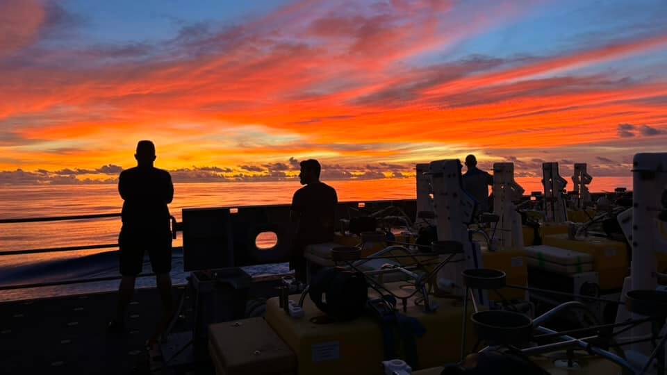
But the best thing was watching the stars at night from the deck. Especially when I was seasick, I wanted to go outside for fresh air whenever possible. It was so dark out at sea, so the stars were absolutely beautiful.
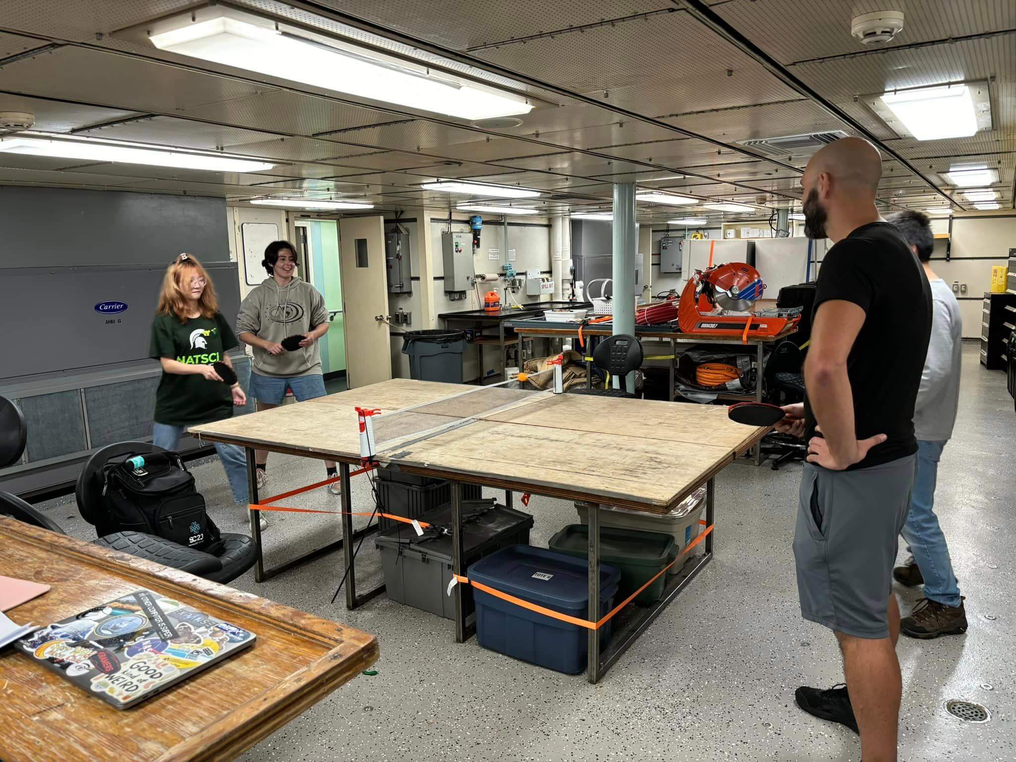
Michigan State University College of Natural Science doctoral candidate Yurong Zhang (lefts) plays table tennis with colleagues aboard the U.S. Research Vessel Thomas G. Thompson. Courtesy of S. Shawn Wei
What was the high point and the low point for you on the ship?
The day we finished all of our tasks was definitely the best moment for me. But I can’t see the data for 18 months, so it’s no time to relax. I’m still crossing my fingers and hoping everything is working well on the seafloor.
The worst time was having sea sickness when we were near the Cook Islands. It was really windy, and the waves were incredible. I used a Scopolamine patch, but the medication messed up my neural system. And I learned my daughter was sick at home at the same time, so I just felt miserable. I just wanted to go home.
You must have really missed your family.
Yes. I tried to Zoom with them every day, but it wasn’t always easy to talk with them because of the time difference. My daughter celebrated her third birthday while I was away and my son was only 5 months old at the time. My daughter understood I was far away, but she didn’t really understand what a research cruise is.
How did you get interested in this type of research?
I grew up in China in mountains and studied Earth science. After going to Tibet, I got into this type of seismology field work, but after applying for Ph.D. programs in the U.S., I realized how there are so few studies on the ocean.
My Ph.D. advisor at Washington University in St. Louis encouraged me to go to the Mariana Islands and the more I studied, the more questions I had. I went to the Scripps Institution of Oceanography in San Diego as a postdoc, which made me realize how much I really wanted to do more sea-going expeditions.
We all know that the ocean covers two-thirds of the Earth. From an observational perspective, there are tens of thousands of seismometers on continents monitoring earthquakes and imaging the Earth, but we know so little about oceans.
Yet the biggest earthquakes are happening in oceans, as well as a lot of volcanoes, so there are a lot of geological phenomena that have yet to be understood.
- Categories: